Communication Technology in the News
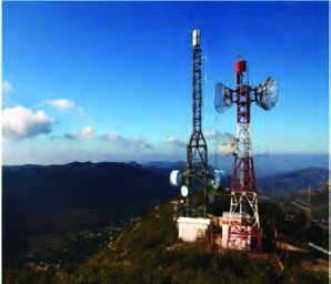
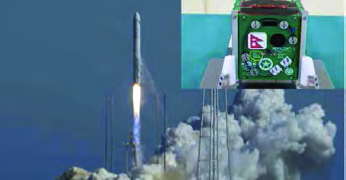
Open any newspaper or news website and you will find stories about communication technology. In three remote rural municipalities of Jajarkot, a telecom company put up towers so that people there could finally use mobile phones. Nepal launched its first satellite, NepaliSat-1, and stepped into the space age. In Chitwan, an elephant named Dhruva was fitted with a satellite radio collar, a band around its neck that reports where the elephant is through a satellite. Nepal Television can now be watched through ordinary broadcast towers, through a satellite dish and over the internet. All four stories share one idea: technology that carries information quickly from one place to another, however far apart they are.


What ICT Means
We live in the age of Information and Communication Technology, usually shortened to ICT. Telephones, mobile phones, fax machines, computers and the internet have linked places all over the world. Sounds, words, pictures and videos can all be stored in a computer as data. That data can then be sent across the internet to another country in a few seconds and used there. A photo taken in Kathmandu, for example, can be seen on a phone in Japan almost as soon as it is taken.
Information and Communication Technology (ICT): the use of electronic devices to store, process and send out large amounts of information.
The definition names three jobs. Storing means keeping information safely. Processing means working on it so that it becomes useful. Transmitting means passing it on to others. Communication satellites have made ICT far more advanced, because a satellite can carry a signal to oceans, high mountains and remote valleys where no tower can reach.
What an Artificial Satellite Is
The Moon travels round and round the Earth, so the Moon is the Earth's natural satellite. People have also built objects that travel around the Earth in the same way and sent them into space. These are called artificial satellites.
Satellite: an object that keeps travelling around the Earth along a fixed path.
Artificial satellite: a man-made object that travels around the Earth.
Orbit: the fixed path a satellite follows as it travels around the Earth.
The first artificial satellite was Sputnik-1. The Soviet Union launched it on 4 October 1957.
How a Satellite Reaches Orbit and Keeps Going
A satellite is carried by a rocket up to a chosen height. There it is launched at a set speed in a direction at right angles to the pull of gravity, that is, sideways rather than towards the Earth. Gravity keeps pulling the satellite towards the Earth, but its sideways speed carries it around the Earth instead of down onto it. It then keeps circling the Earth at that same height. Think of a stone tied to a string and whirled round your head. The string keeps pulling the stone towards your hand, and the stone keeps going round in a circle. For a satellite, gravity does the job of the string.
Once in orbit, a satellite needs no extra energy to keep moving, because there is no air that high up and so no air friction to slow it down. The computers and other instruments inside it still need power, and that comes from solar energy. This is why most satellites carry wing-like solar panels.
It is wrong to think a satellite needs an engine or fuel to keep circling. Its motion needs no extra energy. Solar energy is used only to run the equipment inside.
Uplink and Downlink
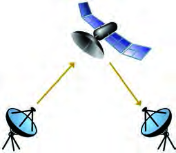
A satellite and a ground station on Earth are linked by microwaves. The ground station sends a signal up to the satellite. The transmitter on the satellite turns that signal into a stronger wave and sends it back down to the Earth. In this way a television programme sent from a station in Kathmandu can travel up to a satellite and come down to a dish on a house in the far west of Nepal.
Uplink signal: the signal a satellite receives from a ground station on Earth.
Downlink signal: the signal that a satellite's transmitter makes stronger and sends back down to the Earth.
The Orbits of Artificial Satellites
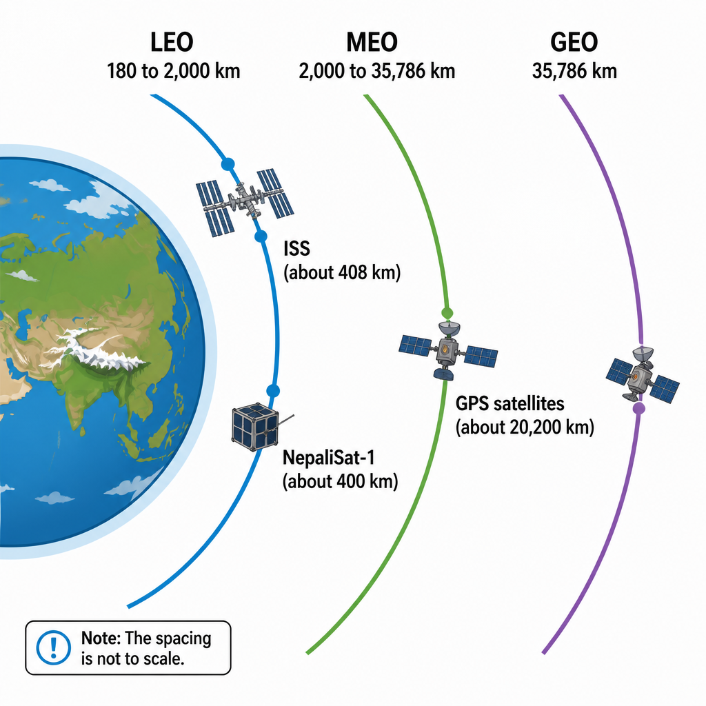
Not every satellite circles at the same height. Each satellite is launched into an orbit chosen for the job it has to do. By their height above the Earth's surface, satellite orbits are grouped into three main types.
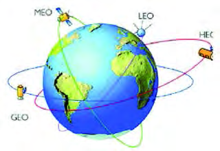
| Orbit | Height above the Earth's surface |
| Low Earth Orbit (LEO) | 180 km to 2,000 km |
| Medium Earth Orbit (MEO) | 2,000 km to 35,786 km |
| Geostationary Orbit (GEO) | 35,786 km |
Low Earth Orbit (LEO)
Satellites that observe the Earth, photograph its surface or carry out scientific research are launched into Low Earth Orbit. Because this orbit is close to the surface, the time the satellite takes to go once around the Earth, its orbital period, is very short. So a LEO satellite stays above any one place for only a short time, but in a single day it passes over many parts of the Earth and can observe them all.
Orbital period: the time a satellite takes to complete one full trip around the Earth.
The International Space Station (ISS) also travels in LEO. It is about 408 km above the Earth's surface and goes once around the Earth in roughly 90 minutes. It is a science laboratory in space where scientists live for months at a time doing experiments and research. One trip every 90 minutes means the station circles the Earth about 16 times in a single day.
Medium Earth Orbit (MEO) and GPS
Navigation satellites travel in Medium Earth Orbit at a height of about 20,200 km. At that height each one takes about 12 hours to go once around the Earth. To reach every part of the Earth, 24 navigation satellites have been launched so that together they form a net around the planet. From anywhere on Earth, some of them are always somewhere in the sky.
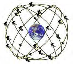
With the help of these navigation satellites, the exact position of any object or person on Earth can be found. A phone map showing where you are standing, an elephant's collar reporting where the elephant has wandered, and an aeroplane finding its route all depend on this system.
GPS (Global Positioning System): the system that uses navigation satellites in MEO to find the position of things on the Earth.
Geostationary Orbit (GEO)
Geostationary Orbit lies directly above the equator at a height of about 35,786 km. A satellite in this orbit takes 23 hours 56 minutes 4 seconds to go once around the Earth. That is exactly the time the Earth takes to spin once on its axis, its rotational period. Because the satellite and the Earth both complete one turn in the same time, the satellite always stays above the same spot on the ground. Seen from the Earth's surface it seems not to move at all, so it is said to be stationary relative to the Earth.
Geostationary Orbit (GEO): the orbit about 35,786 km above the equator in which a satellite's orbital period equals the Earth's rotational period, so the satellite stays fixed above one place on the Earth's surface.
Since a GEO satellite stays above one place, a dish on a rooftop can be pointed at it once and never needs to be turned again. This is why GEO satellites carry television, telephone, mobile and internet signals and support telecommunication. Many countries in the world have launched communication satellites into this orbit. Satellites in LEO and MEO also exchange information with ground stations, with the help of satellites.
Comparing the Three Orbits
| Orbit | Height | Feature | Purpose | Example |
| LEO | 180 km to 2,000 km | Closest; short orbital period | Observation, photographs, research | ISS, NepaliSat-1 |
| MEO | 2,000 km to 35,786 km | Network of 24 satellites; about 12 hours per trip | Finding position (navigation) | GPS satellites |
| GEO | 35,786 km | Stays fixed above one place | Television, telephone, internet | Communication satellites |
What Satellites Are Used For
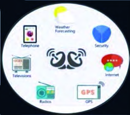
Satellites are part of everyday life. They carry long-distance telephone and mobile calls, bring television and radio programmes to remote villages, connect the internet, find positions through GPS, help forecast the weather and help keep a country secure. When the news tells you whether it will rain tomorrow, that forecast depends on satellites that photograph the clouds from above.
NepaliSat-1: Nepal's First Satellite
NepaliSat-1 is Nepal's first satellite. It was built at Kyutech University in Japan by two Nepali scientists, with money provided by the Nepal Academy of Science and Technology (NAST). Its builders were Abhas Maskey, who was studying space technology, and Hariram Shrestha, who was doing a master's degree in electrical engineering.
Cubical nanosatellite: a very small, light satellite shaped like a cube. NepaliSat-1 is one, with a mass of only 1.33 kg.
NepaliSat-1 reached space in these stages:
- On 18 April 2019 it was launched by rocket from Virginia in the United States and carried to the International Space Station (ISS).
- About a month later, on 17 June 2019, it was released from the ISS into an orbit about 400 km above the Earth's surface.
- It then went around the Earth about once every 90 minutes, staying above Nepal's sky for 6 to 10 minutes on each pass.
Its height of 400 km and its 90-minute orbit show that NepaliSat-1 is a Low Earth Orbit satellite. A LEO satellite stays above any one place for only a short time, which is why it was over Nepal for just a few minutes at a time. It was launched to photograph Nepal's landforms, forests, glaciers, hills and roads and send those pictures back. With this satellite, Nepal entered the space age.
The full lesson is waiting for you
The notes are free to read in full. A free account opens the rest of the practice, and tracks your progress and confidence score for every subject. Presentations and videos need approval from Learn Yeti.